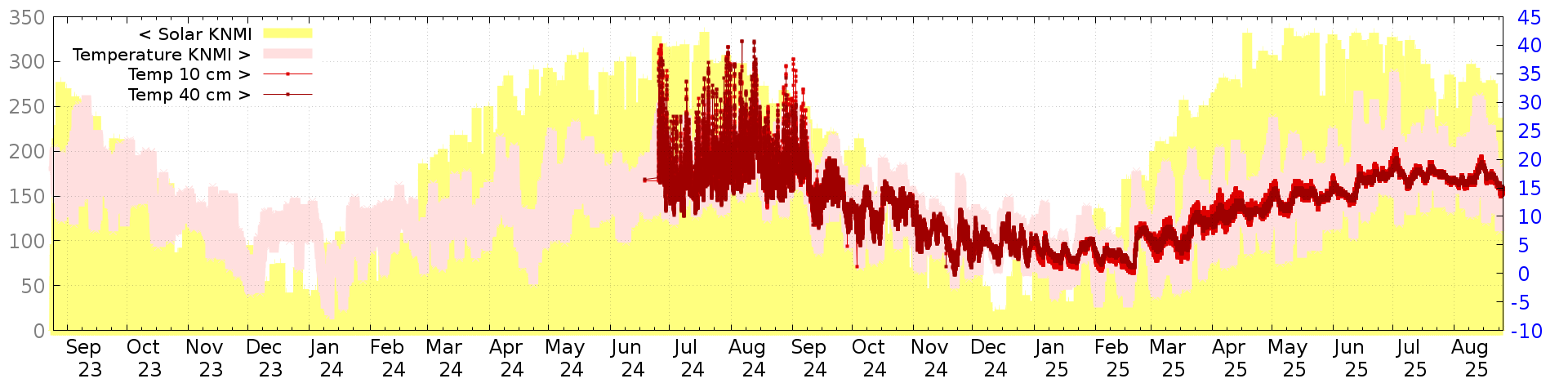
MeetjeStad soil moisture graphs
Device:
| ID | 2127 |
| Type | climate + soil_moisture (since: 20241230) |
| Sensors | si7021 + 2xpinotechsw10_2xntc10k + vsolar (since: 20241230) |
| Soil | sand, measuring depths 10,40 cm |
| Location | 52.16480 N, 5.39393 E |
| field | function | multiplier | offset | ||||
|---|---|---|---|---|---|---|---|
| extra0 | soilM1 | a=0.049 | b=-5.100 | α=0 | β=0.02 | γ=0.02 | |
| extra1 | soilT1 | a=0.250 | b=-20.000 | ||||
| extra2 | soilM2 | a=0.049 | b=-4.700 | α=0 | β=0.02 | γ=0.02 | |
| extra3 | soilT2 | a=0.250 | b=-20.000 |
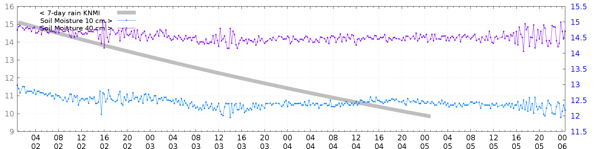
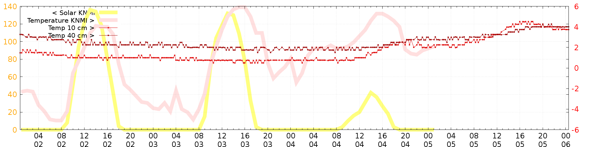
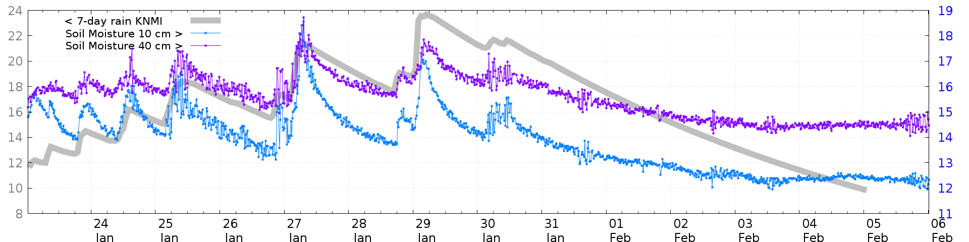
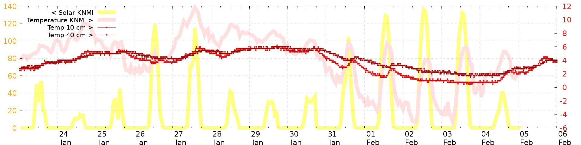
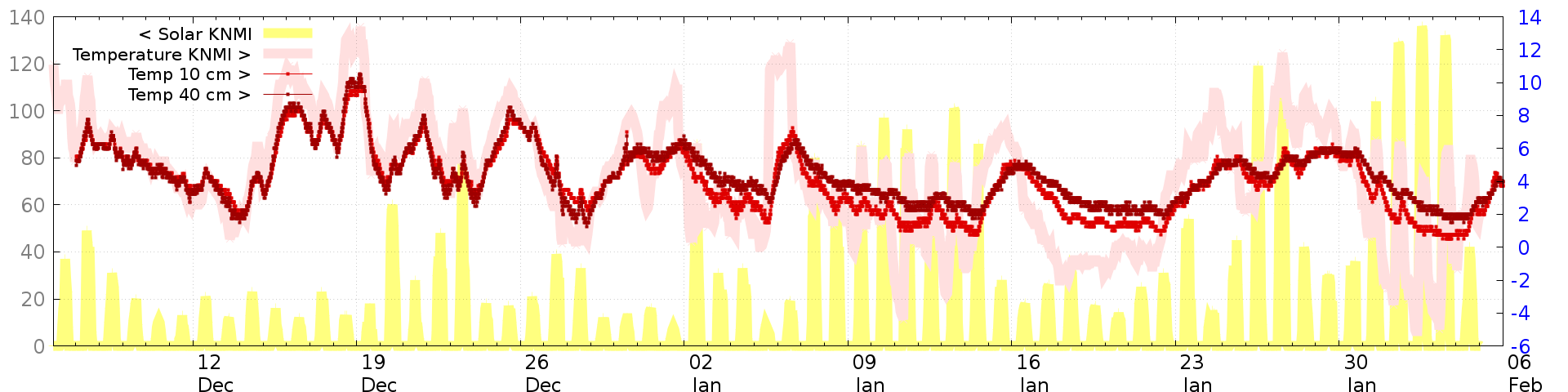
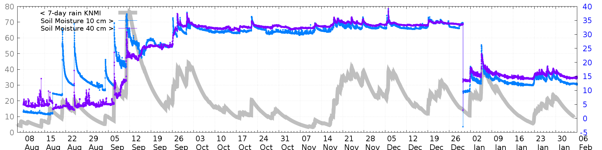
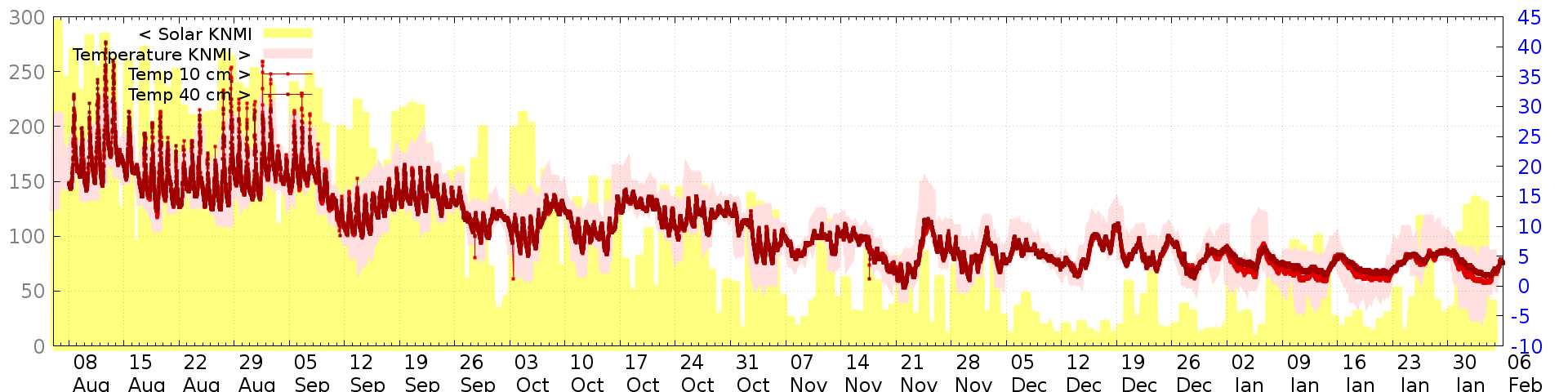
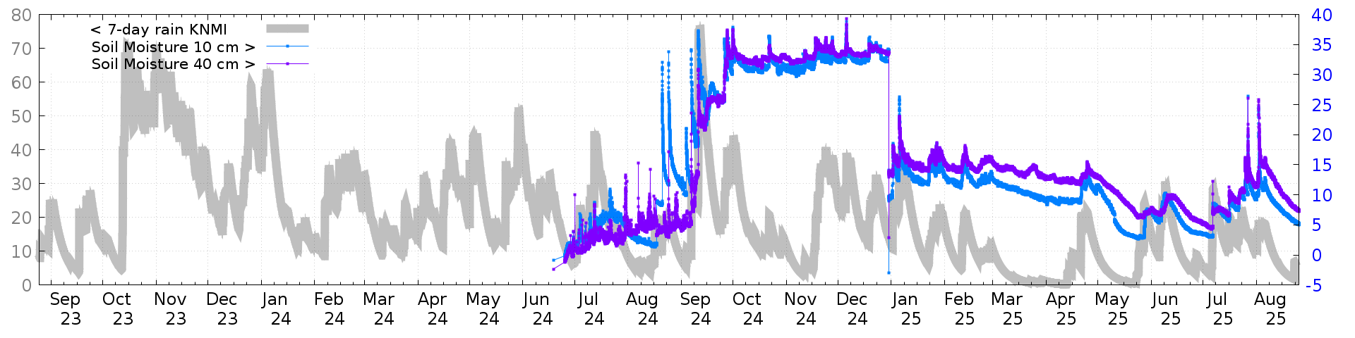
| measurements of the last 4 days measurements of the last 2 weeks measurements of the last 2 months measurements of the last 6 months measurements of the last 2 years |